The former railway area between East and West Pasila now houses the finished Tripla central block, Pasila station, and the renovated Pasila Bridge, connecting the East and West sides. The Ratapihakorttelit (Rail Yard Quarters) under construction in the railway area will further connect the two areas. Middle Pasila’s Rail Yard Quarters will be built between 2018 and 2030 near excellent public transport and services on the north side of Pasila’s new centre, Tripla.
The 14-hectare Rail Yard Quarters will provide diverse urban housing for 3,200 city residents and offices for as many as 1,000 workers. The blocks will have day-care centres along with Pasila’s primary school for grades 1–9.
The height of the buildings will range from 6 to 15 stories, and the southern area bordering the central block will have taller buildings. The area’s public exterior space will also have art.
The Pasila Tower Area will be built on the south side of Pasila Bridge. The Keskitorni (Middle Tower) office building being built between Veturitie and the railway will connect the central block and Veturitallit (old roundhouse area) together. The area’s western towers will also have housing with incredible views. The area’s three eastern towers will be built on a thin strip of land on the east side of the tracks, connecting Middle Pasila to Savonkatu and Alppiharju.
Middle Pasila’s Rail Yard Quarters
Temporary traffic arrangements near Pasila Comprehensive School and Daycare Aurinkokello
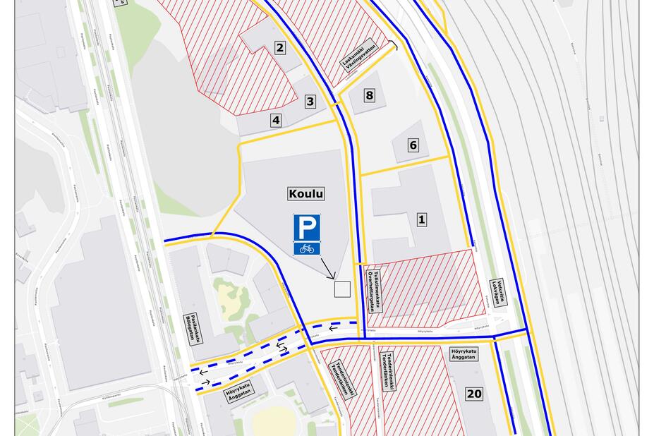
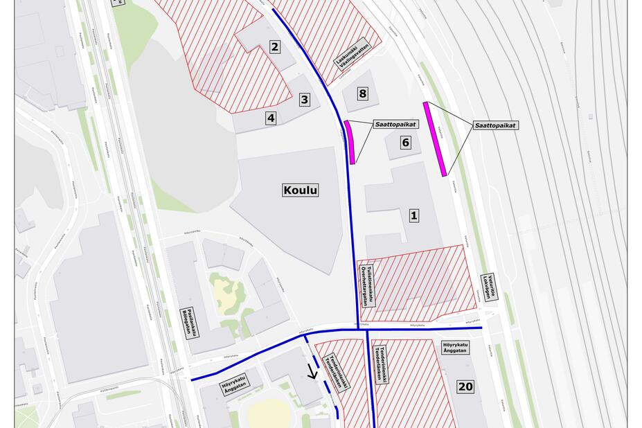
Pasila Comprehensive School and Daycare Aurinkokello will open at their new location at the address Tulistimenkatu 2 on the Monday following the autumn break, 20 October 2025. There are several active construction sites in the area around the school and daycare centre, and temporary traffic arrangements are in place in the area.
The City of Helsinki encourages schoolchildren and people travelling to and from the daycare centre to travel on foot or by bike or public transport. The nearest public transport stops are located along Pasilankatu street, north of Höyrykatu street. You should go with your children to get to know their future school route beforehand.
If you intend to transport your child to and from school or daycare by car, there are a few parking spaces meant for drop-off and pick-up traffic along Tulistimenkatu street. These parking spaces have a 15-minute parking time limit. The map shows the main routes to the school on foot and by bike, as well as the nearest public transport stops.
We will inform you of any changes to the transport arrangements via the school or daycare centre.
You can give us feedback on the temporary traffic arrangements at:
https://palautteet.hel.fi/en (Link leads to external service)

